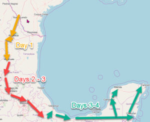
The next stop on our journey is through southern Chiapas. If you’ve made it to San Cristobal de las Casas, good for you! Too few tourists get to this part of Mexico. Or maybe it’s better to keep the riffraff out, and there are just enough tourists. The entire state of Chiapas is culturally different from the rest of Mexico.
I wrote about San Cristobal earlier. There are lots of places to see and experience there. It is also cold. The following natural attractions are warmer, but not a steamy jungle. You could stay in San Cristobal and visit them, but that would entail about an hour’s drive each way. It is doable but seems like a lot of work to me. You could also take a tour bus which will free you from driving and give you more time at the sites since they can drive back at night.
My suggestion is that you move down to Comitán for a few days and really take your time to enjoy the lakes and waterfalls. Besides, Comitán is another of those overlooked Mexican towns. It feels like old Mexico.
Southern Chiapas: Comitán & The Lakes Region
Comitán de Dominguez is only 51 ½ miles (83.4 KM) from San Cristobal. The road is mostly 2-lane, has plenty of curves and topes to slow you down. Comitán is hardly in the flatlands, but at 5,500 feet (1,670 meters) it is a heck of a lot warmer than San Cristobal. There are plenty of hotels that cost less than ones in San Cristobal. There is no RV park, but there MAY be one at the turnoff for the waterfalls by now.
There was a hotel under construction at the gas station south of town at the crossroads that appeared to be setting up space for trailers and RV’s. Ask about it at the RV park you stayed at in San Cristobal and at the tourism department before you commit. Of course you can always boondock.
An excellent hotel, with a businessman’s hotel flavor, is La Casa de Marqués de Comillas. Parking is very secure. I stayed here. It is a block south of the square and very quiet at 2a Calle Norte Poniente #6. They have a pool. There are others on the major highway that looked okay. The downtown ones looked kind of run-down, but cheap. The one exception is that the nicest hotel with a pool is Hotel Hacienda de los Angeles, Calle Segunda Nte. Pte. #6, Centro.
If you want to visit lakes and the waterfalls the same day, start with the falls. But it’s better to use each attraction as one-day trip.
Waterfalls At El Chiflón Eco-park
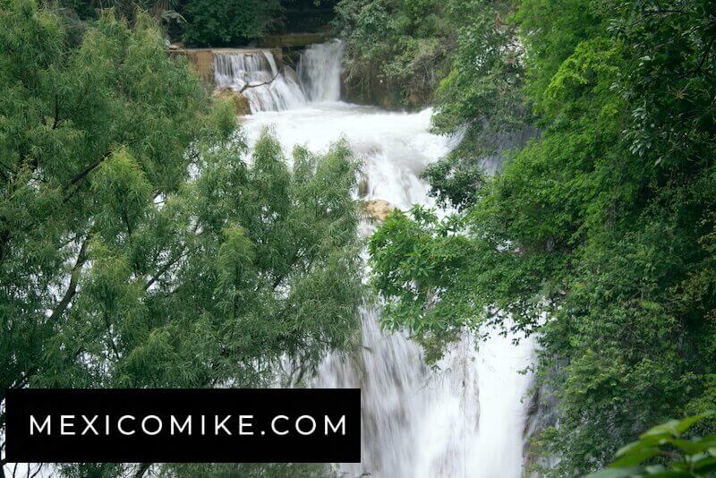
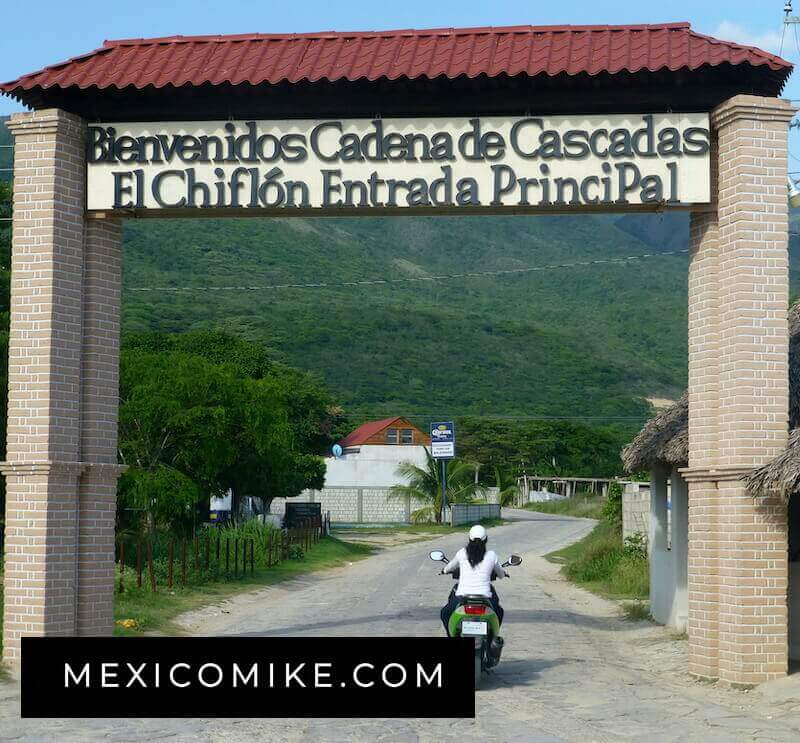
El Chiflón is the name of a waterfall park about 45 minuted drive from Comitán. Drive south about ten miles. There is a gas station on the left. There is a sign for Cascadas or Tzimol to the right. Go 20 miles on a paved road, but be hypervigilant for topes! Go through the village of San Cristobalito. There are some humble, but spotless, and pleasant restaurants along the principal street. I found the people here very nice and open. This is a coop and the people here take pride in where they live. Keep driving a few miles to a well-marked turnoff to the right. There is a small fee to enter. The parking lot seemed safe, so don’t worry about your vehicle getting broken into.
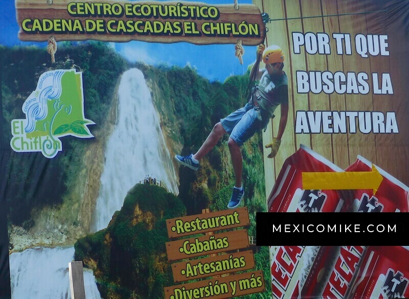
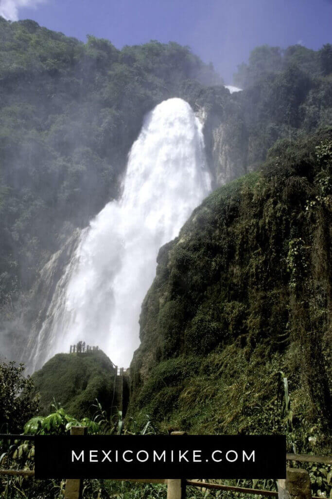
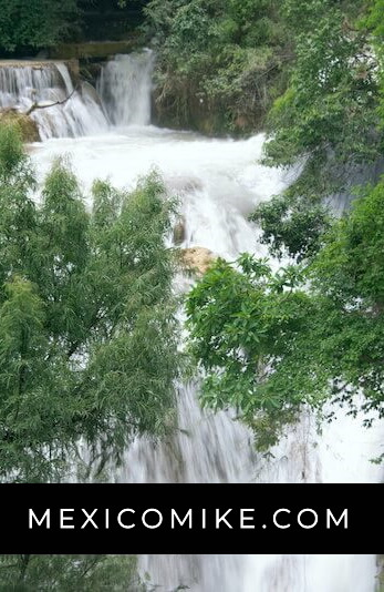
There are five falls, each unique. The first is Cascada Suspiro 25 meters tall (560 meters walk). Next is the gentle Las Alas del Angel (wings of the angel). The last (easy to get to) is the tallest, the Cascada Vela de Novia or Bridal Veil. It has a drop of 360 feet (120 meters) and is 43 feet or 70 meters wide. The walk to it is 1,200 meters, some of which is uphill. There are benches to rest. Bridal Veil Falls has a zipline. There are two falls beyond here for dedicated hikers.
Near to the entrance, there are a few simple but adequate cabins. There are small food stands too. I read online there is a restaurant. I surely did not see it, but I could be wrong. Park hours are roughly 7:00 AM – 5:30 PM. PH: 963-703-6584.
A collective of local people from San Cristobalito operate and maintain the park. They take a lot of pride in it. The Lagunas park is different. They are trash-strewn and you get more of a feeling of being hustled.
The path, though marked and roped, is uneven and sometimes steep. The last steps to the observation tower of the big waterfall are treacherous because they are wet. I made it, glad I had bought rain sleeves for my cameras, but frankly, it was not worth the effort or the risk.
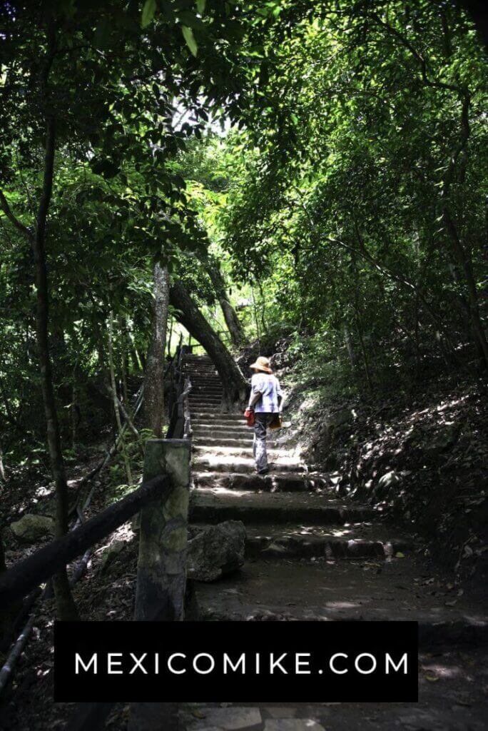
The walk would take a person in good shape about an hour. But figure on spending some time enjoying yourself. I’d allow about 2-3 hours here. If you feel up to it, you can go on to the lakes region.
The Lakes Region – Lagunas de Montebello
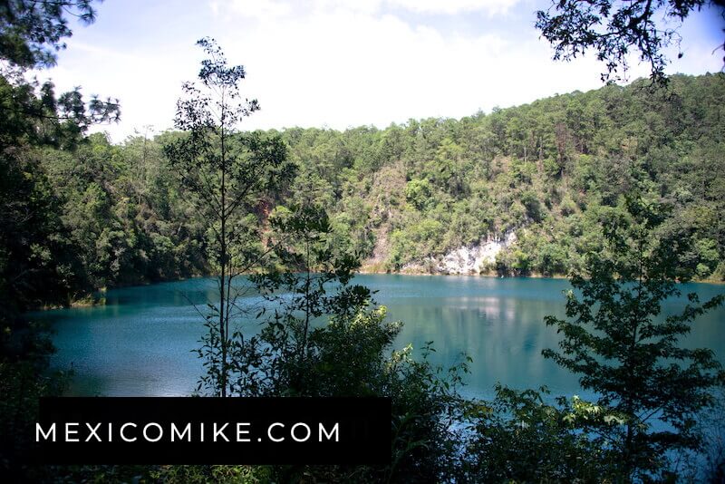
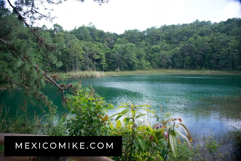
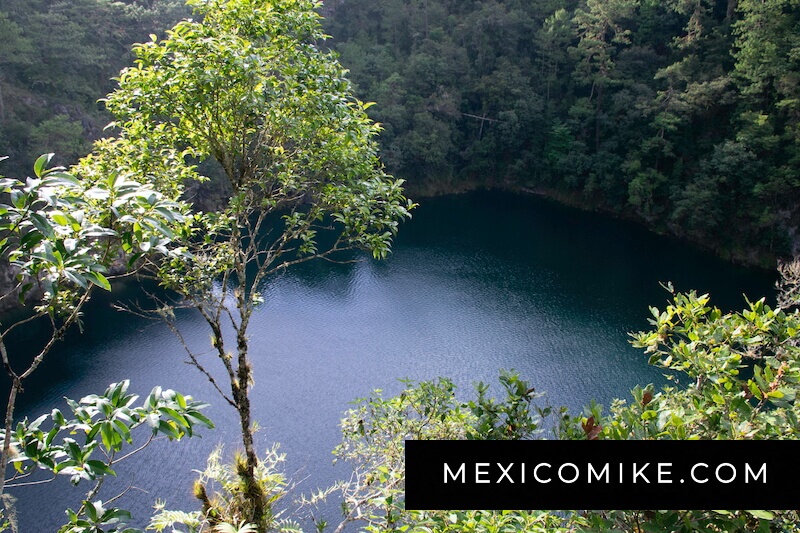
Next to see are the Lagunas de Montebello (also known as Lagos de Montebello). People compare them to Alpine lakes in Europe. I can’t speak to that, but you could bring your lederhosen and alpenhorn and see if they fit in.
Locals say there are fifty-nine lakes in the area. Each one has a different color. Some have aquamarine, clear water like the Caribbean. Some sport green, bright blue, dark blue or other colors depending on the mineral content. The time of day and reflection of the sun will also influence your experience.
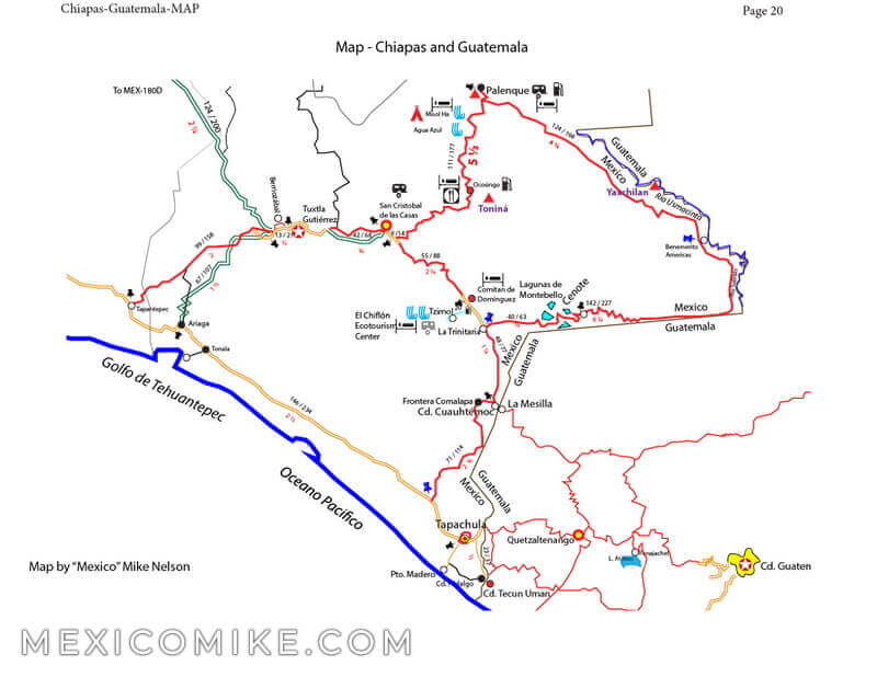
To get to the lakes region of southern Chiapas, go south of Comitán 20 KM on MEX-190. At La Trinitaria, (the first junction to your left), turn left. Go ahead on 2-lane paved road until you see some lakes.
Watch out for a man in what you could mistake for a uniform. He will say you must park on the side of the road and hire a guide. This is BS. Thank him for his advice and keep driving until you see a lake on the left or right. Many have parking lots and you can park at one and go off to explore for others. If you feel you need a guide to explore beyond the easy access lakes, ask around and be sure you get someone who speaks English. Otherwise, you won’t learn anything.
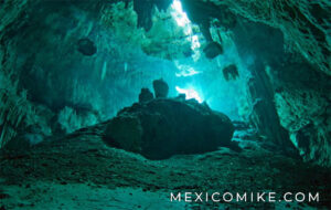
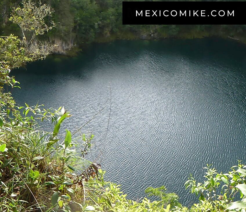
Park. There are tons of kids who are rather uncouth, but harmless, if aggressive. Pay the ringleader a few pesos to watch the car and take off to the trails. There are lakes on both sides. The last one, with a small, identifiable cenote, (though technically all the lakes are cenotes) is worth driving to. Leave the first lake and keep driving straight. There will be a sign that you will probably miss, saying, “Cenote” to your left. There are also native women who will direct you there for a small fee. Heck, they need the money. If you get to a nondescript village, you have gone too far. Retrace your steps.
There IS a fee to park by the cenote and if there is no one around the entrance, someone will come to find you. Pay them. The lake in front of you is mildly interesting, but the cenote is to the right of the parking area, maybe half a mile on a dirt road. The toll-taker will point it out to you, though once you know it is there it is obvious. Park and walk up the big hill on a series of hand-hewn steps. It is quite a hike, but once you get to the summit, the view of the aquamarine or emerald or deep blue (it all depends on the clouds that day) cenote way down below you is worth the effort. (vale la pena).
Some parking lots have stalls where local women cook some kind of meat and fish on a grill. I ate some and didn’t die, so I guess it is okay. Actually, I’d rather see my food prepared in front of me than in the bowels of a kitchen. The food stands close early, about 4 PM or when they run out of food, so eat sooner rather than later.
When you’re finished with the lakes retrace your steps to the main highway and head back to Comitán. This will complete your southern Chiapas journey. You will have put one of the least-visited and most beautiful destinations in Mexico under your belt. Wear it proudly!