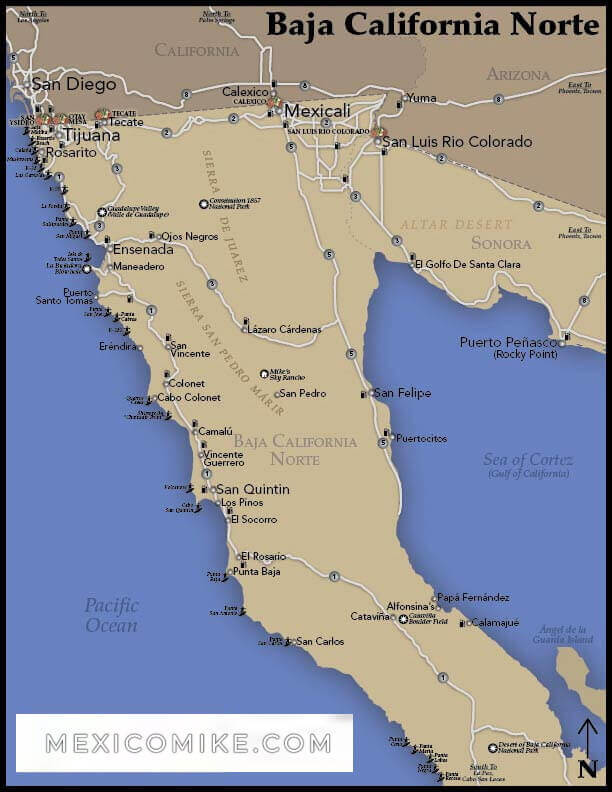
This map of Baja, the state of Baja California, is one of Mexico’s most popular travel destinations. Visitors to Baja can check the Baja map to locate the cities and regions of interest. The Baja map will help travelers plan their itineraries with accessible driving routes.
Baja California occupies the northern half of the Baja Peninsula. The Baja is 27, 071 square miles of unique climates and geographical features. From its interior mountains and desert terrain to its magnificent coastal waters and beaches, the state is famous for its many things to see and do. Use the Baja map to locate beaches, major thoroughfares, and city sections.
Baja Map: Tijuana to Ensenada
As a major border city, Tijuana acts as an essential gateway to the state of Baja California as well as the nation of Mexico. When driving in northern Mexico, Tijuana is a great place to begin a journey since highways easily connect it to other major Baja cities as you can see on the Baja map. The 73-mile trip to Ensenada from Tijuana takes less than two hours.
- Tijuana to Ensenada Free (Libre):
- Going north on Avenida Constitucion and turn right on Calle 4TA.
- Turn left on Avenida Revolucion and then right on Calle 2DA.
- Veer slightly left to merge onto Tecate/Mex 2.
- Then, make a slight left on Via Poniente.
- Via Poniente will become Avenida Internacional and then Periferico within a couple of miles.
- Head onto the ramp for Mex 1D/Ensenada and then merge onto Carretera Ensenada-Tijuana.
- Remain on Carretera Ensenada-Tijuana and then follow the signs for Mex 1 Carretera Transpeninsular.
- Head slightly left onto Mex 1/Esmeralda and then turned left on-ramp where you’ll merge onto Ejercito Nacional.
- At Avenida Cortes, take a right. At Avenida Mexico, make a left.
- Go right on Avenida Manuel M. Ponce and head straight into Ensenada.
- Tijuana to Ensenada Toll (Cuota):
- Hop on the Toll road in Tijuana for Rosarito/Ensenada, exit in Ensenada
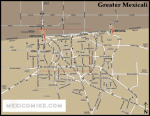
Mexicali to Tijuana
As the state capital, Mexicali is also a popularly visited border town. The 114-mile trip takes roughly two and a half hours to complete across the northern stretch of the state.
You can see from the Baja map, that the trek is approximately a straight shot west of the capital city.
- Head east on Rio Ticolutla and turn left on Calle Novena.
- Make a left on Boulevard Lazaro Cardenas and follow the signs, Tijuana
- Take the Heroico Colegio Militar exit, which becomes Mex-2.
- Mex-2 becomes Mex-2D which you should take to Boulevard Industrial by making a slight right onto the ramp.
- Merge onto Boulevard Lazaro Cardenas which becomes Avenida Internacional.
- Take a left at Boulevard Cuauhtemoc Norte and then head straight to merge onto Boulevard Cuauhtemoc Sur.
- Make a slight right at Rio Suchiate and then turn left on Boulevard Cuauhtemoc Sur Pte.
- Make a right on Boulevard Agua Caliente which becomes Avenida Revolucion.
- Turn left on Calle 5TA then west on Avenida Constitucion and head into town.