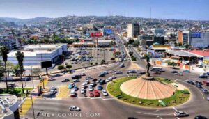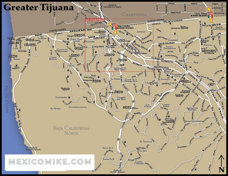
Travelers can use the Tijuana map to locate border crossings, routes, and other geographic information to plan their travel itinerary to Baja in Mexico. Viewing the Tijuana map also allows tourists to locate city sections, regions, and landmarks that will enhance a stay in the city. The following information includes driving directions as well as other geographic information to help travelers find their way around the city using the Tijuana map.
Travelers can use the Tijuana map to locate border crossings, routes, and other geographic information to plan their travel itinerary to Baja in Mexico. Viewing the Tijuana map also allows tourists to locate city sections, regions, and landmarks that will enhance a stay in the city. The following information includes driving directions as well as other geographic information to help travelers find their way around the city using the Tijuana map.
San Diego to Tijuana Driving Directions
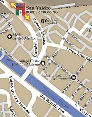
Travelers coming from San Diego, California can take 17th Street to I-5 S heading into the Mexican state of Baja California. After crossing the border, I-5 S becomes Circuito Bursatil. Using the Tijuana map, locate the ramp that heads toward Centro for C3RA / Avenido Revolucion; you’ll turn slightly left to access the ramp. Drivers will continue to head straight on Calle 3RA for less than half a mile. Then, turn left onto Avenida Revolucion. Next, turn right onto Calle 5 TA / Pio Pico. Finally, the first left is Avenida Constitucion which takes you into Tijuana.
Phoenix to TijuanaDriving Directions
Heading west from Phoenix, Arizona to Tijuana is slightly less than a six-hour drive. Using the Tijuana map, travelers should take the I-10 West to Los Angeles. You’ll remain on I-10 West for about thirty miles. Take Exit 112 onto AZ 85 / S. Remain heading straight onto East Pima Street for a short time until merging onto I-8 West to San Diego. You’ll remain on I-8 West for nearly 273 miles. Merge onto CA 125 North exit to the CA 125 South exit. After roughly 6.5 miles, you’ll take the CA 154 West exit for about four miles. Then, merge onto I-805 South which becomes I-5 S as you cross into the Mexican state of Baja California.
After crossing the border, I-5 S becomes Circuito Bursatil. Using the Tijuana map, locate the ramp that heads toward Centro for C3RA / Avenido Revolucion; you’ll turn slightly left to access the ramp. Drivers will continue to head straight on Calle 3RA for less than half a mile. Then, turn left onto Avenida Revolucion. Next, turn right onto Calle 5 TA / Pio Pico. Finally, the first left is Avenida Constitucion leading into Tijuana.
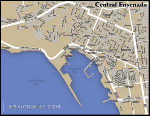
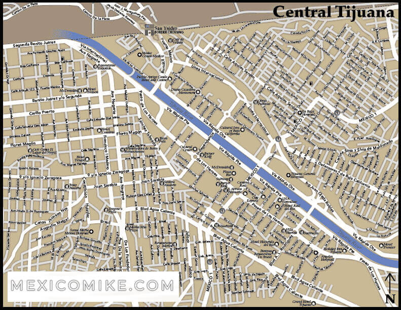
Map of the City
After getting through the central loop taking you into Tijuana, drivers will notice many major thoroughfares leading in various directions—roads to Rosarito Beach, Ensenada, and, of course, elsewhere in the city itself. The Tijuana map features main streets that lead to important city sections like the Paseo de los Heroes. The Avenida Revolucion and the streets leading up to it are filled with shops, restaurants, cafes, clubs, and various venues that cater to the city’s large tourist population. To locate other city squares of interest or landmarks, cultural attractions, or historical sites, use the Tijuana map to locate major thoroughfares that will lead to these Tijuana locations.
Getting around Tijuana is easy if you use the map and plan your itinerary. Be sure to include the street addresses of the sites you wish to visit so you can locate them more easily on the map. Also, be sure to purchase insurance for driving in Mexico upon crossing the border.