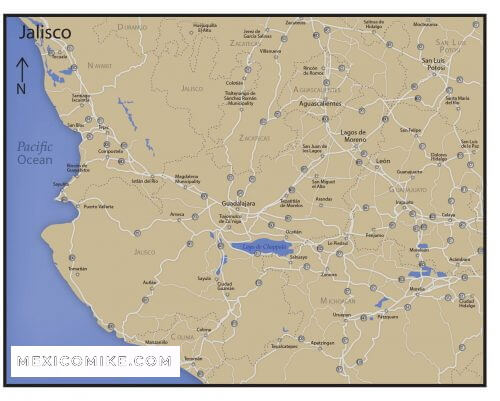
Download this Jalisco map to plan your journey to one of the largest states in Mexico.
Jalisco is next to the Pacific Ocean to the west. It neighbors Michoacán, Guanajuato, Colima, Nayarit, Zacatecas, and Aguascalientes. The state of Jalisco is the seventh-largest state in all of Mexico. Jalisco is home to all kinds of natural features including forests, beaches, plains, and lakes. Around 45 to 50 percent of the landmass of Jalisco is forest. Most of this being spread along the coastal plains to the west. There are also forested areas towards the center of the state.
The Cities of Jalisco: Jalisco Map
Jalisco has grown to encompass several smaller municipalities around the state. Notable cities include Tlaquepaque, the affluent city of Zapopán and the colonial towns of Tonalá and El Salto. The majority of people in Jalisco live in urban areas – around 87 percent of residents compared to 77 percent nationally.
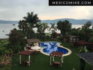
At the heart of Jalisco is Guadalajara – one of the biggest cities by population in all of Mexico. Guadalajara is home to over half of the state’s residents. It also acts as the cultural and financial hub of the state. Around 45 kilometers southeast of Guadalajara is Lago de Chapala. Lago de Chapala (Lake Chapala) is Mexico’s largest freshwater lake. It is around 80 km long and almost 18 km wide at its widest point. Lago de Chapala is fed by the Rio Lerma and the Rio Zula. It drains to the Rio Grande de Santiago.
Places to see on the Jalisco Map
The Costalegre, Spanish for ‘Coast of Joy’, is an area along the west coast of Jalisco. It encompasses a number of different beaches, capes, and bays of varying sizes. The towns and villages along the west coast of Jalisco are popular with tourists. The combination of beautiful beaches and hot weather ensures annual visitors keep coming back.
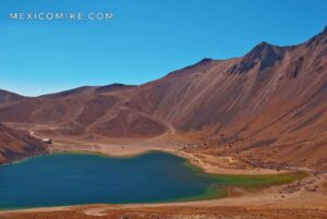
The Trans-Mexican Volcanic Belt runs through the entire state of Jalisco and on throughout the rest of Mexico. It includes the Nevado de Colima, the Volcan de Colima, the Sierra El Madroño, the Tequila Volcano.