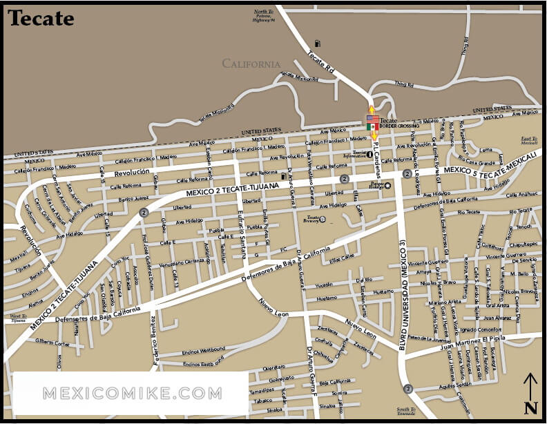
These Tecate maps and driving directions to Tecate will help take you to one of Baja California’s most picturesque locales. The mountainous city of Tecate is a favorite destination among travelers crossing the border into Mexico. Using the Tecate map, drivers can plan their trip and travel itinerary. The Tecate map also allows visitors to the city to easily find landmarks and specific addresses throughout the city as well as to navigate the surrounding region which also contains many scenic attractions popular with tourists to Tecate. Tecate has maintained its natural beauty and visitors especially enjoy the green surroundings and fresh mountain air.
San Diego, California to Tecate Driving Directions
The trip from San Diego to Tecate takes roughly an hour and is just around forty miles. Its proximity to this major California city makes it a popular weekend getaway for many Americans in search of a Mexican holiday. Drivers should take CA-94 E to Campo Road/CA-94 and turn right. Make a slight right at Tecate Road/CA-188. From this point, there are less than two miles to go until travelers enter Tecate. Use the Tecate map to chart your trip; the easy Tecate driving directions, however, make a Tecate excursion perfectly simple for anyone looking to cross the border.
Phoenix, Arizona to Tecate Driving Directions
The trip from Phoenix to Tecate takes roughly five hours and is a 320-mile journey. The Tecate map indicates that the journey is a relatively easy distance. From Phoenix, drivers should take I-10 W toward Los Angeles. At exit 112, merge onto AZ-85 S to I-8 Yuma/San Diego. Head toward W Pima St. and merge onto I-8 W taking the ramp toward San Diego. This is the longest stretch of the journey at about 220 miles. Take exit 65 toward Ribbon Rd/CA-94 to Campo Blvd. Then, make a left on CA-94/Ribbonwood Rd. Turn right at CA-94/Old World Hwy 80, then turn left at CA-188 S/Tecate Rd. Turn right onto CA-188/Tecate Rd and head into Tecate. (Tecate driving directions from Phoenix).
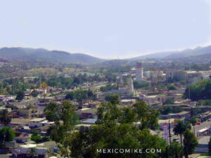
Exploring Tecate
The Tecate map allows visitors to the city to easily locate main thoroughfares, squares, and various city sections. Tecate boasts renowned resorts, scenic attractions, campgrounds, and even the nearby vineyards and wineries of Valle de Guadalupe that boast some of the best wines of North America. Many tourists who visit Tecate make a point to visit the historic brewery that produces Tecate Beer. The Old Tecate Railroad Station also draws a crowd. For outdoor enthusiasts, the map can help locate exciting areas to enjoy hiking or horseback riding.
Because there are so many places in northern Mexico to get off the beaten track, a map of the region is essential. From mountain peaks to Native American sites to more scenic delights, Tecate is the ideal place to experience northern Mexico’s natural charms. The Tecate map can also help tourists locate hotels, inns, restaurants, shopping venues, and other historic and cultural attractions of the city. Be sure to consult the map if you decide to head beyond Tecate to other Baja California cities like Mexicali, Rosarito Beach, Tijuana, Puerto Nuevo, or Ensenada.