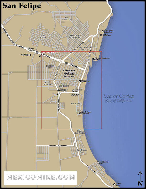
Follow these San Felipe maps and directions to San Felipe on the Sea of Cortez is one of Western Baja California’s most stunning destinations. Due to its proximity to the U.S. border, it is also a convenient location; many travelers drive from the U.S. or other cities in Mexico to enjoy San Felipe’s gorgeous beaches and scenic charms. Using the San Felipe map, travelers can easily navigate their journey to this exotic city. Moreover, the map can help them find locations within and immediately surrounding the city.
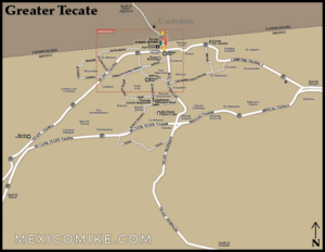
In just over 4 hours (without construction or border delays) you’ll go from one paradise to another. We like to cross at Tecate (Click here for the Tecate Map) because it is a small, simple border crossing without much traffic on the other side. Head South on 5 to 94 East, Turn right onto CA-94 E/Campo Rd. After 23 miles turn slightly right onto CA-188 S/Tecate Rd and continue for about 2 miles until you cross into Mexico. Follow the signs for Mexicali/Tecate Route 2 (Mexico 2) which takes you west toward Mexicali (Click here for the Mexicali Maps). Merge onto Mexicali 2D after 2 miles for the toll road and stay on this for over 60 miles until you see Mexico 5 toward San Felipe. Drive Mexico 5 (Carr Federal 5) for 120 miles approximately until you arrive in San Felipe.
Tucson to San Felipe Driving Directions
This seven-and-a-half-hour journey through the desert is well worth the effort! Drivers should go north on S. Scott Avenue heading toward E. Congress St. Make a left on E. Congress St. and then a right onto N. Freeway. Head onto I-10 taking the ramp toward Phoenix. Next, merge onto I-8 W taking the 199 exits toward San Diego. Take CA-118A toward Calexico and cross into Mexico. You’ll see on the map that CA-111S becomes Avenida Francisco I Madero; be sure to veer left to stay on Avenida Francisco I Madero. Make a slight right on Adolfo Lopez Mateos and head toward San Felipe/San Luis. Eventually, Adolfo Lopez Mateos becomes Boulevard Rafael Sanchez Taboada/Carretera San Luis Rio Colorado. Make a slight right on Benito Juarez and then a slight right on Calzada Benito Juarez. Calzada Benito Juarez turns into MEX-5 and then MEX-5 will turn into Chetumal. Head through one roundabout and turn right onto Avenida Mar Bermejo and head into San Felipe.
Ensenada to San Felipe Driving Directions
Many travelers use their maps to head from the Pacific city of Ensenada to San Felipe. Head southeast on MEX-1 toward Avenida Alvarado. Make a slight left on MEX-1/Esmeralda and then continue to follow Esmeralda. Turning left onto the ramp, veer onto Ejercito Nacional. Make a right on Avenida Cortes and then left on Calle 6TA which will become Flores Magon. Flores Magon then becomes Carretera El Chinero-Ensenada. Carretera El Chinero-Ensenada becomes MEX-3 and MEX-3, as you’ll see on the map, becomes Carretera a San Felipe. Then, Carretera a San Felipe becomes MEX-3 / El Chinero-Ensenada again. Merge onto MEX-5 / Carretera San Felipe El Oasis which will then become Chetumal. Head through one roundabout and turn right onto Avenida Mar Bermejo. Head into San Felipe!
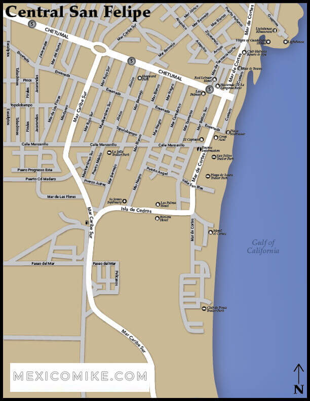
Navigating San Felipe
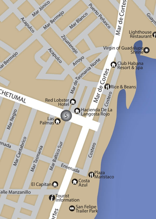
Once you reach this seaside destination, you can use the map to navigate outlying areas. Discover breathtaking desert reserves and picturesque fishing villages. Within San Felipe, you can use the map to locate hotels, restaurants, clubs, and other attractions scattered throughout the town. Look for markets to buy fresh fruit, seafood, and artisan-made crafts. When traveling north or south of San Felipe, be sure to have a map, a cell phone, and plenty of water in the car as the desert climate can be harsh and the terrain is remote between locales. With so many scenic attractions in this part of Baja California, the San Felipe map is essential for reaching the most popular spots.