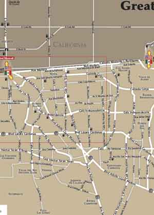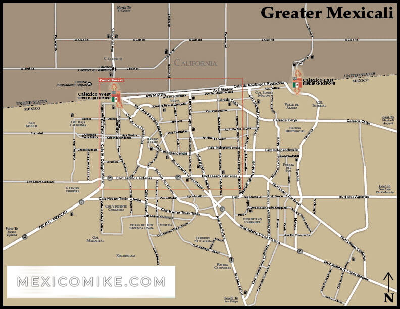
Viewing the Mexicali map and following these directions to Mexicali will allow travelers to easily navigate their drive to this capital of Baja California. You’ll also be able to locate various sections of the city and find addresses for interesting cultural attractions. The Mexicali map features routes to the city as well as major thoroughfares within the city itself. Keep the Mexicali map on hand as you follow your driving directions to Mexicali.
San Diego to Mexicali Driving Directions
The trip to Mexicali from San Diego takes slightly more than two hours. The 126-mile trip can be charted using the Mexicali map. Drivers should take I-5 S to exit 16 toward CA-163 North to Escondido. Within a few minutes, take exit 3A and merge onto I-8 E heading toward El Centro. This is the longest stretch of the trip. You’ll remain on I-8 E for about an hour and a half. Take exit 87 and merge onto CA-98 E / Yuma Cutoff and head toward Calexico for about a half-hour. Turn right heading onto S Imperial Ave and cross into Mexico. Turn left onto Adolfo Lopez Mateos and remain on this street taking a slight right. Then turn right onto Benito Juarez, one of the main thoroughfares of Mexicali.
Tucson, Arizona to Mexicali Driving Directions
Plenty of Arizonans travel to Mexicali each year. By checking out the Mexicali map, drivers can see that the route from Tucson to Mexicali is nearly a straight drive west. From North Freeway Street, drivers should take I-10 West for roughly fifty-seven miles driving for about an hour. Merge onto I-8 West at exit 199 toward San Diego. Head onto CA-98 at exit 143 toward Calexico. Turn left onto CA-98 West. Enter Mexico by turning left onto Imperial Ave. Turn left onto Adolfo Lopez Mateos taking care to remain on this avenue by taking a slight right. Turn right onto Benito Juarez and enjoy Mexicali!
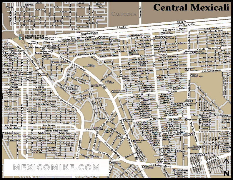
Getting Around Mexicali
The Mexicali map can help you locate important streets, find accommodations, and locate natural or cultural venues in and around the city. Mexicali boasts the second-largest municipality in the state. As the state capital, Mexicali offers a wide array of things to see and do. Mexicali has fourteen boroughs and a further thirteen boroughs in the valley region. The city and its surrounding region feature many museums, restaurants, shops, clubs, landmarks, and hotels. Many visitors to Mexicali enjoy its artistic venues or come to enjoy outdoor activities like cycling or off-roading. Fishing and golf are also popular among travelers to the capital.
Mexicali can also easily be reached from Tecate and Tijuana driving along Mex-2. The drive from Mexicali on Mexican Highway 5 to San Felipe, located on the Sea of Cortez, is also a popular trip. Northern Mexico features many reserves and naturally appealing scenery and the map can help you locate the best routes to take you anywhere around the region. Other popular trips from Mexicali include drives to Rosarito Beach, Guadalupe Valley, Ensenada, and even Rocky Point (known in Mexico as Puerto Penasco).