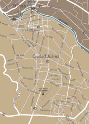
Ciudad Juarez, Chihuahua is one of the most active cities in Mexico. With the Ciudad Juarez Map, it’s easy to get there. Whether you’re coming from another city in Mexico or heading down from El Paso, Texas, you’ve got plenty of options for getting to and through Ciudad Juarez.
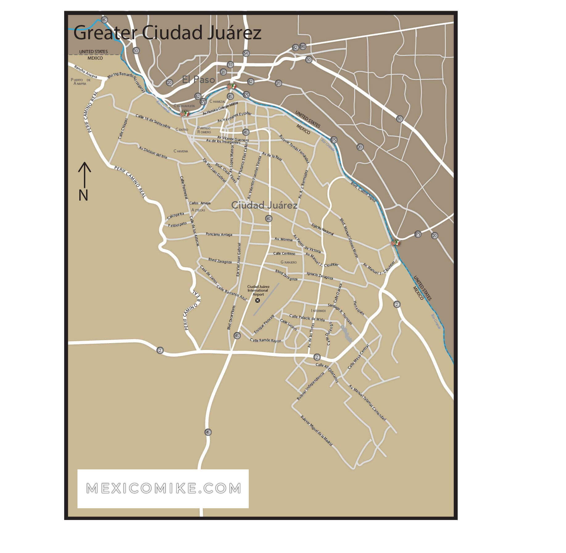
Ciudad Juarez Map: Direction from the U.S.
If you’re coming from the north, you can get to Ciudad Juarez from El Paso by traveling down Interstate 110. This route will take you past the El Paso Zoo on the American side and right into the heart of the city on the Ciudad Juarez side. Best of all, this is one of the simplest routes into Ciudad Juarez.
Ciudad Juarez Map: From Points in Mexico
For those planning on coming to Ciudad Juarez from the west once they’re already in Mexico, odds are the route will begin with Nogales or Agua Prieta. From here, you can take Interstate 2 along the Mexico-U.S. border until you get to Ciudad Juarez. This is a nice scenic route but also takes a bit longer than some of the other routes.
If you’re coming to Ciudad Juarez from the east, chances are you’re traveling along Interstate 10 or 62. Both of these routes take you through Texas and eventually lead to Mexico right around Ciudad Juarez, which means you won’t get to see as much of Mexico when you take these routes. However, it is a fairly quick way to get to Ciudad Juarez.
Ciudad Juarez is a popular destination for people to visit on their way out of Mexico. This is why a lot of visitors come from the south. The best way to get to Juarez from the south is via Interstate 45 from the city of Chihuahua. This path gives you beautiful scenery.