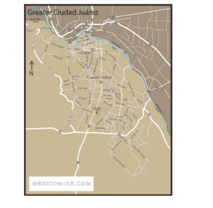
Contact Mike

Decades of first hand Mexico tourism information from me, "Mexico" Mike Nelson.

Chihuahua Maps

CHIHUAHUA MAPS
The Chihuahua maps are valuable for navigating or planning your trip through the State of Chihuahua Mexico for your Mexico travels...

Chihuahua Maps
The Chihuahua maps can help you navigate your trip or plan a trip. If you click the map above, you will download it to your local device.
Chihuahua City
Chihuahua City Map
Chihuahua City Map

This city can be a little crowded and hectic, but if you download this map above it can make your life easier. Download the Chihuahua City map to your mobile device. With or without the Internet, you can find your way in and out of this city.

Driving to Chihuahua from El Paso

  • From the TX-375 Loop East, drive 9.5 miles
  • Take the Zaragosa/International Bridge
  • Continue onto S Americas Avenue (signs for Zaragoza Rd)
  • You enter Mexico from S Americas Ave
  • Continue straight for .2 miles over the bridge
  • Take the ramp on the left onto Blvd. Independencia for 3.5 miles
  • Continue onto El Porvenir – Ciudad Juarez for 4.5 miles
  • Keep right to continue on Av Manuel Talamas Camandari for .3 miles and enter the roundabout
  • Take the last exit from the roundabout toward Chihuahua and go for .3 miles
  • Merge onto Chihuahua/Miguel Ahumada/Panamericana/Mexico 45 (toll road) for 71 miles
  • Continue onto Miguel Ahumada – Chihuahua/Mexico 45 D for 52 miles (toll road)
  • Stay on 45/Chihuahua Centro until you arrive (about 4 miles)

related posts

Palacio de las Bellas Artes

Top 50 Sites to See in Mexico

It almost goes without saying that Driving in Mexico boasts far more than a mere fifty attractions to see when traveling through the country.  Yet the following sites and attractions are among the most famous

Read More »
CHIHUAHUA

Chihuahua

The northwestern state of Chihuahua is located on the border with the U.S. states of New Mexico and Texas. It borders the Mexican states of

Read More »
CIUDAD JUAREZ MAP

Ciudad Juarez Map

Ciudad Juarez, Chihuahua is one of the most active cities in Mexico. With the Ciudad Juarez Map, it’s easy to get there. Whether you’re coming from another city in Mexico or heading down from El Paso, Texas, you’ve got plenty of options

Read More »
Monterrey Nuevo Leon Map Thumbnail

Map of Monterrey

Below I am providing you the actual map and road log to get through the border to Monterrey and onto Saltillo or other parts. The map of Monterrey and the corresponding directions show which

Read More »
en_USEN
Chihuahua Maps

4 - Chihuahua

How will you get to Chihuahua?